Sold out for the 2026 race As read 14 October 2026.
Past years and every way in
Entry details on the organiser’s site →
Spor İstanbul, a third party. We take no entries and have no part in the race.
 Marathon Trip
Your trips on every device: sign in, or make a free account when you save one.
Signed in on this browser.
Sign in My marathons Account and dataLocked out? An export link you keep still opens your list in any browser.
No account: email it to me
One email with this trip and a link to open it again. We do not keep the address and send nothing else.
Only a race from our list can be emailed. An account keeps this one.
What we keep, and what we do notCheck your inbox at to confirm it.
Browse the racesEach edition the day it comes out, and nothing else. Off again with one click. How it is kept.
Imagery: Google Earth and its imagery providers
A climb of 39 m to km 4, downhill to km 10, then a steep climb of 33 m home from km 40.
© OpenStreetMap contributors
km 0mile 0
About 250 m short of the Asian toll plaza of the Bosphorus Bridge, in front of the 15 Temmuz Şehitler Köprüsü metrobus stop, where the organiser's 42K page puts the start.
Photo: Jorge Láscar from Australia, CC BY 2.0
km 1.2mile 0.8
Officially the 15 July Martyrs Bridge. The course is on the deck from km 0.42 to 1.97 and crosses from Asia to Europe.
Photo: Huseyinakbas63, CC BY 4.0
km 6.1mile 3.8
Built 1843-1853 for Sultan Abdülmecid I on the European shore of the Bosphorus. The course passes it 107 m off at km 6.13 on Dolmabahçe Caddesi; the organiser's list marks it at 6K.
Photo: queulat00 from Santiago, Chile, CC BY 2.0
km 8.8mile 5.4
Built by the Genoese in 1348 at the top of their walled colony of Galata, 66.9 m tall. The course passes below it 216 m off, on the runner's right, at km 8.76 on the way to the Galata Bridge.
Photo: Nan Palmero from San Antonio, TX, USA, CC BY 2.0
km 9.3mile 5.8
The course's only crossing of the Golden Horn, Karaköy to Eminönü, at km 9.3. The current bridge, the fifth on the site, was built in 1994: a bascule bridge 490 m long.
Photo: HALUK COMERTEL, CC BY 3.0
km 11.2mile 6.9
On Seraglio Point above the coast road, 314 m off at km 11.18. The course passes it again on the climb through Gülhane Park, 176 m off at km 41.03.
Photo: Jorge Láscar from Australia, CC BY 2.0
km 17.9mile 11.1
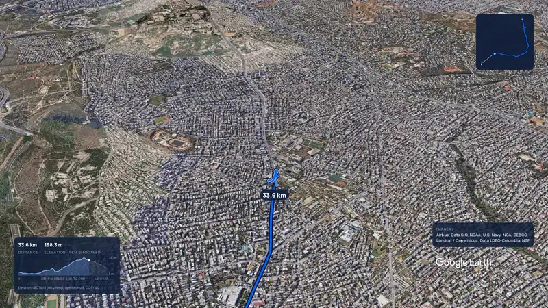
Built 1458 for Mehmed II, enclosing the Golden Gate of the Theodosian land walls. 327 m off the coast road at km 17.86, and 310 m on the way back at km 33.62.
Photo: Mister No, CC BY 3.0
km 25.7mile 16
The course's one U-turn, at the Air Force Academy vehicle gate in Yeşilköy by the organiser's 42K page; from here it runs back along the same coast road.
Photo: Alessandro57, CC BY 4.0
km 41.8mile 26
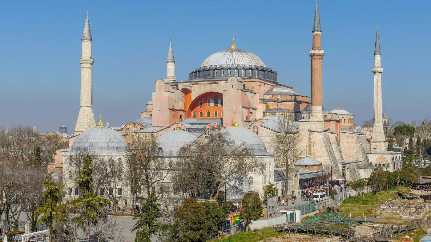
Completed in AD 537. The course passes it 123 m off at km 41.83, on the tramway road between Gülhane Park and Sultanahmet Square.
Photo: Arian Zwegers, CC BY 2.0
km 42.2mile 26.2
At Meydanı, between the Blue Mosque's gate and the Obelisk of Theodosius, where the organiser's 42K page puts the line.
Photo: José Luis Filpo Cabana, CC BY 3.0
Height drawn many times taller than life. Heights: GEDTM30.
Dashed: bridge upright dashes: cut-offs

Your 5 gels, at the orange marksFor a 4:00 finish, one every 40 minutes
Get them on AmazonAmazon partner link
Istanbul puts its drama at both ends and almost nothing in between. The start is in Asia, and by km 1.2 the field is in Europe, halfway across a bridge nobody may walk. The course reaches its highest point at km 3.8, then drops 78 m to the Bosphorus in 2 km, the steepest stretch of the race, while every leg in the field is fresh. After that comes 30.7 km of coast road beside the Sea of Marmara, out to a turn and back, never more than 7.9 m above the water. The last 2 km climb through Gülhane Park to the Hippodrome. Run the descent with the brakes on and keep something for the end.
The course is point to point, from the Asian end of the Bosphorus Bridge to Sultanahmet in the old city. The kilometres and heights below are measured along the organiser’s 2025 course map, the latest it has published, on a 30 m global elevation model. The organiser’s 2026 street list was not readable at the time of writing, so check its 42K page for any change.
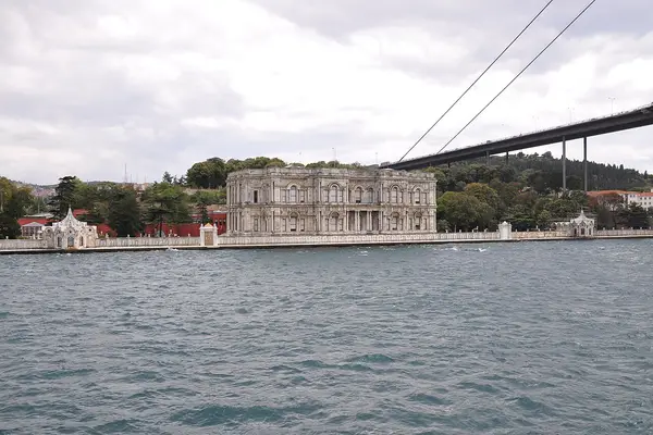
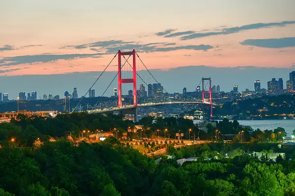
The start is about 250 m short of the toll plaza at the Asian end of the bridge, in front of the 15 Temmuz Şehitler Köprüsü metrobus stop. That is the bridge’s official name; it is better known as the Bosphorus Bridge. The course is on its deck from about km 0.43 to km 1.97, 64 m above the water, and Asia ends and Europe begins mid-strait at about km 1.2. The bridge carried pedestrians for only its first three years after it opened in 1973, and none today, so on race morning the field runs a road nobody else can walk.
Off the bridge the road keeps climbing, 18.9 m from about km 2.9 up to Balmumcu, and at km 3.8 it reaches 87.2 m above the sea. Nothing later comes close. Then the course turns down Barbaros Bulvarı and falls 77.8 m in 2 km to the Bosphorus shore at km 5.8. From km 4.5 it drops 7.3% over half a kilometre, the steepest gradient on the course. It comes in the first 6 km, when it is easiest to run it too fast and pay for it on the coast road later.
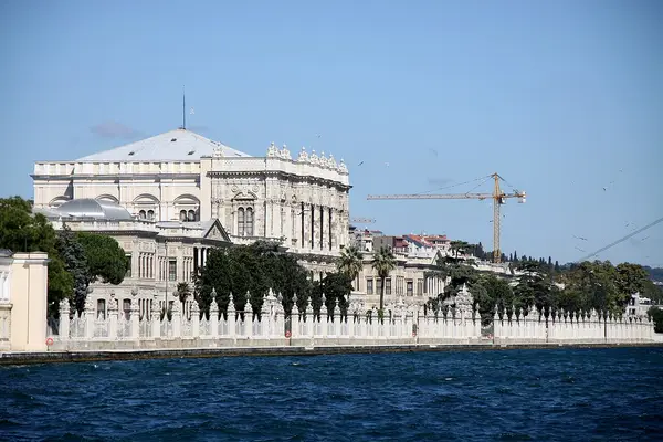
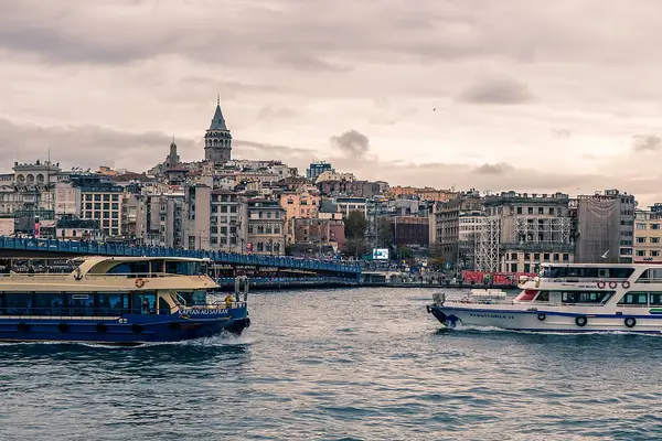
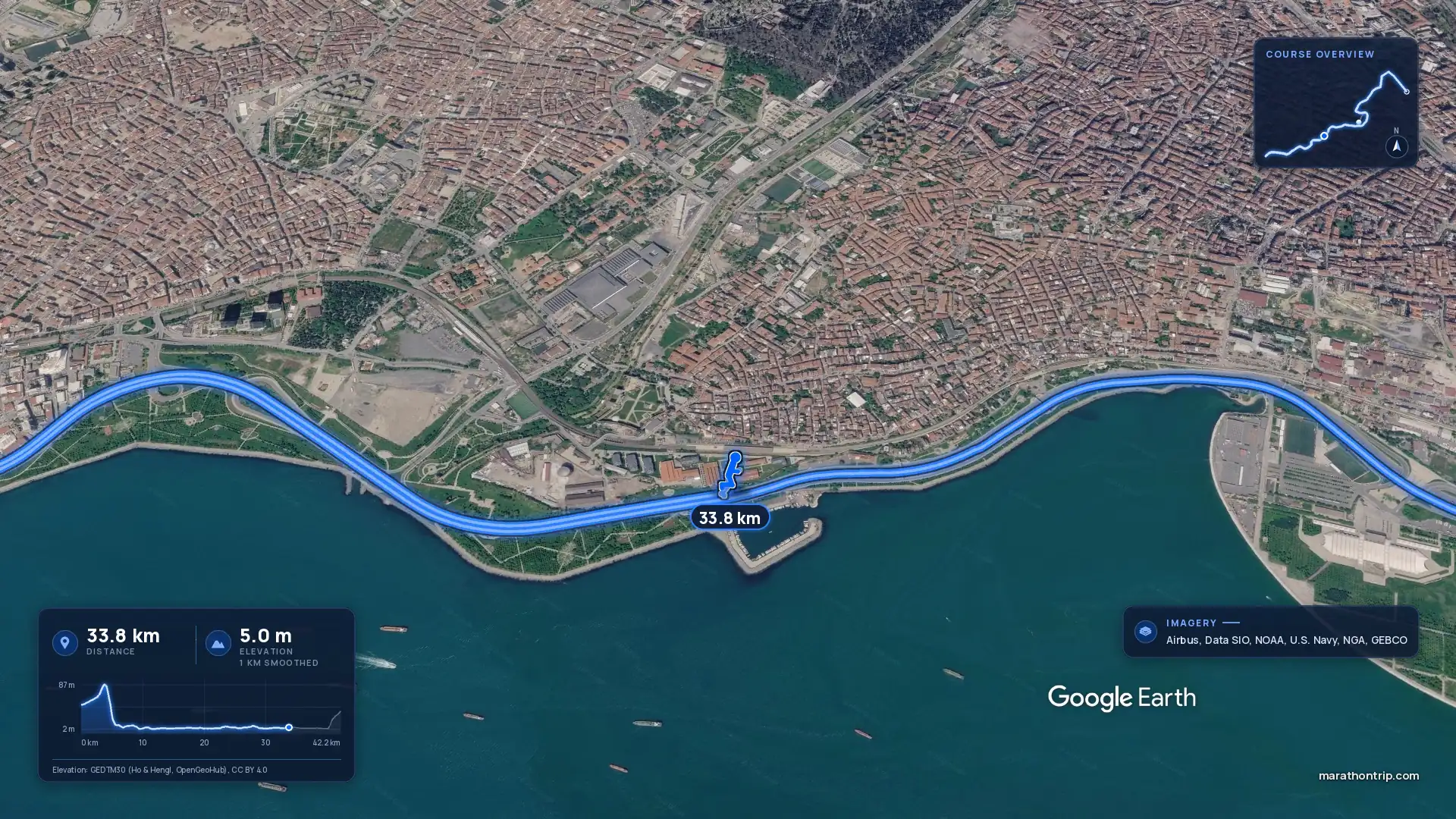
The course follows the European shore past Dolmabahçe Palace, about 100 m off at km 6.1, and under Galata Tower, up on the runner’s right at about km 8.8. At about km 9.3 it crosses the Golden Horn on the Galata Bridge, from Karaköy to Eminönü, its only crossing of that inlet. By km 10 it has rounded Seraglio Point, with Topkapı Palace above the road at about km 11.2, and met the Sea of Marmara.
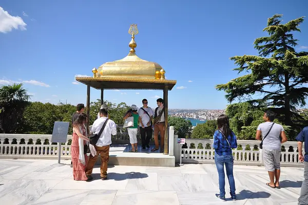
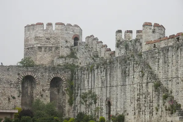
From here the course is one coast road, out and back. It starts as Kennedy Caddesi, which runs along the line of the old sea walls, with the sea beside it the whole way. It passes below Yedikule Fortress at about km 17.9, where the land walls meet the sea at the Marble Tower, 35 m from the course at km 18.5. Halfway falls on this road. The turn is a single U-turn at about km 25.7 on Rauf Orbay Caddesi in Yeşilköy, at the Air Force Academy’s vehicle gate. On the way out you meet the leaders already coming home on the other side of the road.
On the coast road the highest point is 7.9 m above the sea, and between km 5.8 and km 40.3 the course never rises 10 m. This is the fast part of the race, and the place to settle into a rhythm.
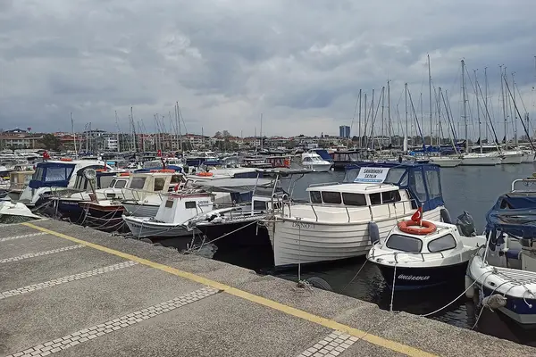
The return is the same road in the other direction, past Yedikule again at about km 33.6, with the runners still on their way out across the road. It lifts only gently as it nears the old city, so the work of the last 2 km is still to come at km 40.
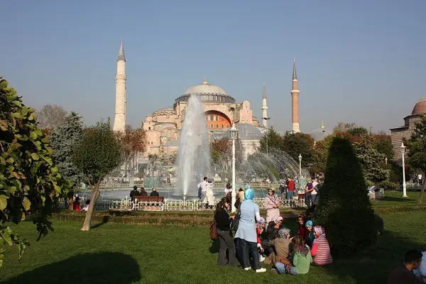
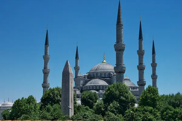
The first half of the race falls 95.3 m and the second half climbs 45.8 m, and most of that climb waits for the end: 33.2 m in the last 5 km. From km 40.3 the course leaves the sea and climbs 2.7% over half a kilometre through Gülhane Park, the steepest uphill of the race, passing below Topkapı Palace a second time at about km 41.0. It then runs on the tramway road past Hagia Sophia at about km 41.8 to the line in the Hippodrome, between the gate of the Blue Mosque and the Obelisk of Theodosius. The finish is 37.2 m above the sea, 11.5 m lower than the start, but the race ends climbing.
From Asia to Europe across the Bosphorus Bridge, a bridge nobody may walk, run on race morning; then down to the sea, over the Golden Horn and 30 km along the Marmara shore, to a finish in the Hippodrome at Sultanahmet.
The Istanbul Marathon is a point-to-point course of 42.2 km with 95.9 m of climbing. Its lowest point is 2 m and its highest 87 m above sea level.
The organiser’s site, maraton.istanbul, is Turkish by default with an English version, and the English race-day page has in the past carried the programme of an earlier year. The 2026 programme is the Turkish race-day page, which names the new 15.5K, so it cannot be an old one. The older address istanbulmarathon.org is no longer the organiser’s: it redirects away from the race, and nothing found there comes from it.
There is no expo, only a kit pickup, at the Dr. Mimar Kadir Topbaş Gösteri ve Sanat Merkezi in Yenikapı. It is open from Thursday 29 to Saturday 31 October, 10:00 to 19:00, and to 18:00 on the Saturday. There is no pickup on race day, so a runner who lands on Sunday morning does not start. The kit holds the bib, the timing chip and the bag for the baggage buses. Yenikapı is a Marmaray station, on the same line that runs to Üsküdar for the start.
Getting from Europe to a start in Asia is the logistics of this race. The organiser runs runner ferries from Kabataş and Eminönü piers between 06:45 and 07:45, and a signed walk leads from the pier at Beylerbeyi to the start. The other way is Marmaray to Üsküdar, from Sirkeci (one tram stop from Sultanahmet) or Yenikapı, and then a free ring shuttle that runs from 07:00 to 08:00 from in front of Üsküdar Marmaray station to Beylerbeyi. Marmaray is paid, unlike the rest: metro and buses are free with your bib until 17:00, and ferries until 15:00. Trams and the Kabataş funicular run from 06:00. There are no runner buses from Taksim or Sultanahmet.
The ferries and the shuttle serve the new 15.5K too, which has 15,000 places of its own, so expect company on the boat.
Bags go onto the baggage buses at the start by 09:00 at the latest, and the buses leave for the finish at 09:10. The wheelchair race starts at 08:45 and the marathon at 09:00. The organiser publishes wave times only for the 15.5K and the public runs, not for the marathon.
The limit is 6 hours 20 minutes, and every cut-off is counted from the 09:00 gun, not from the moment you cross the line. The first is at 1 km, at 09:10, and the rest come every 5 km: 09:45 at 5 km, 10:32 at 10 km, 12:04 at 20 km, 13:36 at 30 km and 15:08 at 40 km. The course closes at 15:20. A runner behind the time boards the sweep bus behind the last runner or carries on along the pavement as the roads reopen, and medals go to finishers inside the limit. A runner aiming near the limit should not line up at the very back, since the clock is already running.
Sold out for the 2026 race As read 14 October 2026.
Spor İstanbul, a third party. We take no entries and have no part in the race.
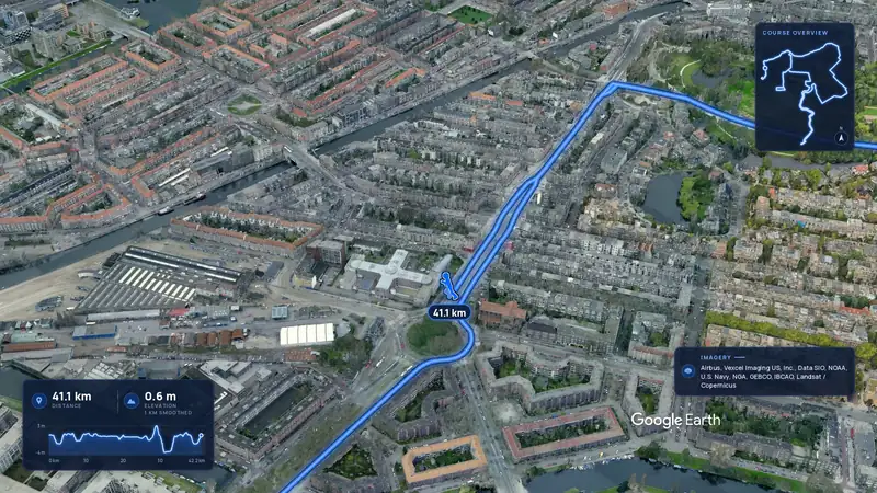 Imagery: Google Earth3:49 film
Amsterdam, Netherlands
Sun 31 Oct 202742.2 kmClimb 22 m
Climb summed after smoothing the heights over 1 km. The edge is this course's height profile on one scale for every race: 250 m above its lowest point fills it.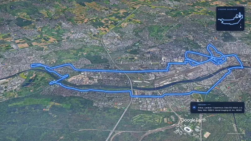 Imagery: Google Earth4:00 filmEntry open
Frankfurt, Germany
Sun 31 Oct 202742.2 kmClimb 44 m
Climb summed after smoothing the heights over 1 km. The edge is this course's height profile on one scale for every race: 250 m above its lowest point fills it.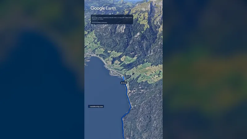 Imagery: Google Earth0:58 film
Lucerne, Switzerland
Sun 31 Oct 202742.2 kmClimb 105 m
Climb summed after smoothing the heights over 1 km. The edge is this course's height profile on one scale for every race: 250 m above its lowest point fills it.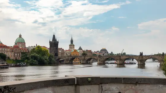
Prague, Czechia
Sun 2 May 202742.2 kmClimb 98 m
Climb summed after smoothing the heights over 1 km. The edge is this course's height profile on one scale for every race: 250 m above its lowest point fills it. Photo: Charles Bridge, by Dietmar Rabich, CC BY-SA 4.0, via Wikimedia Commons.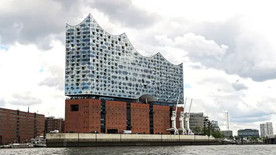
Hamburg, Germany
Sun 25 Apr 202742.2 kmClimb 98 m
Climb summed after smoothing the heights over 1 km. The edge is this course's height profile on one scale for every race: 250 m above its lowest point fills it. Photo: Elbphilharmonie, by Burkhard Mücke, CC BY-SA 4.0, via Wikimedia Commons.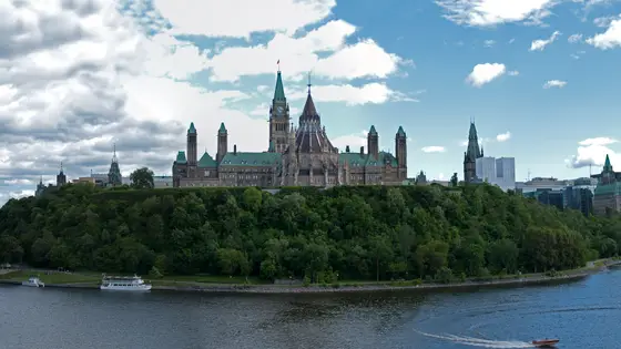
Ottawa, Canada
Sun 30 May 202742.2 kmClimb 99 m
Climb summed after smoothing the heights over 1 km. The edge is this course's height profile on one scale for every race: 250 m above its lowest point fills it. Photo: Parliament Hill, by David Samuel, User:Hellodavey1902, CC BY-SA 3.0, via Wikimedia Commons.Sunday 1 November 2026, the 48th edition. The marathon starts at 09:00 on the Asian side of the Bosphorus Bridge, the wheelchair race at 08:45, and the finish is in the Hippodrome at Sultanahmet.
6 hours 20 minutes, counted from the 09:00 start, so the course closes at 15:20. There are intermediate cut-offs at 1 km and then every 5 km, the first at 09:10. A runner behind the time boards the sweep bus or carries on along the pavement as the roads reopen.
At the Dr. Mimar Kadir Topbaş Gösteri ve Sanat Merkezi in Yenikapı, from Thursday 29 to Saturday 31 October 2026, 10:00 to 19:00 and to 18:00 on the Saturday. There is no pickup on race day. The kit holds the bib, the timing chip and the bag for the baggage buses.
Runner ferries leave Kabataş and Eminönü piers from 06:45 to 07:45, with a signed walk from the pier at Beylerbeyi to the start. A free shuttle runs from 07:00 to 08:00 from in front of Üsküdar Marmaray station to Beylerbeyi. Metro and buses are free with your bib until 17:00, but Marmaray is not. There are no runner buses from Taksim or Sultanahmet.
Mostly. From km 5.8 to km 40.3 the road never rises 10 m above the sea. The hills are at the ends: the course climbs to its high point, 87.2 m, at km 3.8, falls 77.8 m to the Bosphorus in the next 2 km, and climbs 33.2 m in the last 5 km, most of it through Gülhane Park to the finish.
maraton.istanbul, run by Spor İstanbul for the municipality. The older address istanbulmarathon.org is no longer the organiser's and redirects away from the race.
The 2026 race is sold out. Registration opened on 6 January 2026 and closed on 13 October. Entry fee: TRY 1,400 (for the 2026 race). Entry details on the organiser’s site
Runners have 6 h 20 min to finish.
Men: 2:09:44, Daniel Kibet, 2019. Women: 2:18:35, Ruth Chepngetich, 2018.
Yes. A 3D flyover film of the whole course, start to finish (4:06), plays at the top of this page.
No official airport page could be read. A third-party airport guide puts a taxi from Istanbul Airport to the centre at roughly 45 to 60 minutes, and the bus at anything from 30 minutes to more than an hour, depending on traffic. Allow for the upper end.
The finish is in Sultanahmet, and Sirkeci, one tram stop away, has the Marmaray line to Üsküdar for the start. That makes the old city the obvious base: one short trip to the start, and a walk home from the finish. Eminönü, at the old-city end of the Galata Bridge, and Kabataş are the two piers the runner ferries leave from, so the streets around either work as well. Yenikapı, where the kits are handed out, is on Marmaray. A runner who would rather not cross the water on race morning can stay on the Asian side around Üsküdar, where the shuttle to the start leaves.
The Bosphorus Bridge closes to traffic at 03:00 and reopens at 14:00. The whole course, the Eurasia Tunnel included, closes at 06:00, and all roads reopen at 15:30. The organiser’s programme estimates the marathon leaders at the finish at about 11:10, with the marathon awards at 12:30 in Sultanahmet. The 2026 street-by-street list could not be found at the time of writing; the latest one readable is the 2022 list, which kept the Gülhane Park and Sultanahmet Square end closed from 06:00 to 15:30.
The Istanbul Marathon was first held in 1979. It has run under several names, among them the Vodafone Istanbul Marathon and the Intercontinental Istanbul Eurasia Marathon, and in 2012, as the Vodafone Istanbul Eurasia Marathon, it held an IAAF Gold Label. Today it is the Türkiye İş Bankası Istanbul Marathon, organised by Spor İstanbul for the municipality, and the 2026 race is the 48th.
The marathon itself has stayed small beside the crowd around it. Wikipedia counts 571 finishers in 2003, 3,404 in 2018 and 3,006 in 2021, while the whole event drew about 20,000 runners across its races in 2013. In 2025 more than 41,000 people from 126 countries took part across the day’s events, and the marathon had about 6,000 entries. For 2026 the marathon is capped at 7,500 places, and it sold out before entries closed on 13 October. In the pandemic year of 2020 the course started and finished in Yenikapı and crossed the bridge twice.
The men’s course record is 2:09:44, set by Daniel Kibet of Kenya in 2019, and it was still standing after the 2025 race. The women’s best is 2:18:35 by Ruth Chepngetich of Kenya in 2018, a Turkish all-comers record; the course has changed since, so it is the race’s record rather than this course’s. Recent winners have run well outside both marks: Rhonzas Kilimo of Kenya won in 2:10:12 in 2025 and Bizuager Aderra of Ethiopia in 2:26:19, after Dejene Debela (2:11:40) and Ruth Jebet of Bahrain (2:24:45) in 2024, and Panuel Mkungo (2:10:35) and Beatrice Cheptoo (2:27:09) in 2023.
Checked against these sources on .
Film stills: Google Earth
42.2 km
 Google Earth
Race week
 Google Earth
Race week