
Ballot closed for the 2027 race As read 25 September 2026.
Past years and every way in
Entry details on the organiser’s site →
The organiser, a third party. We take no entries and have no part in the race.
 Marathon Trip
Your trips on every device: sign in, or make a free account when you save one.
Signed in on this browser.
Sign in My marathons Account and dataLocked out? An export link you keep still opens your list in any browser.
No account: email it to me
One email with this trip and a link to open it again. We do not keep the address and send nothing else.
Only a race from our list can be emailed. An account keeps this one.
What we keep, and what we do notCheck your inbox at to confirm it.
Browse the racesEach edition the day it comes out, and nothing else. Off again with one click. How it is kept.
A climb of 25 m from km 4 to km 10, another climb of 26 m from km 30 to km 32, then downhill to km 37.
© OpenStreetMap contributors
km 0mile 0
The start is on Fritz Sonnenberg Road beside the stadium; the 2026 route map names it the Stadium Start.
Photo: Deklerk Basson dkbasson, CC0
km 3.3mile 2
The course runs along the Waterfront's edge on Helen Suzman Boulevard, with the Table Mountain view point just after.
Photo: lumoplank, CC0
km 11.9mile 7.4
Passed on Main Road in Rondebosch, labelled km 11.8 on the organiser's 2026 route map.
km 26.9mile 16.7
Passed on Albert Road in Woodstock on the way back to the city, labelled km 27 on the organiser's 2026 route map.
km 29.9mile 18.6
The oldest colonial building in South Africa, passed on Darling Street.
Photo: scott marsland, CC BY 3.0
km 30.1mile 18.7
On the Grand Parade beside Darling Street.
Photo: Danie van der Merwe, CC BY 2.0
km 30.7mile 19.1
On Wale Street at the top of Government Avenue.
Photo: Mike Hayes, Public domain
km 30.9mile 19.2
The course runs the length of Government Avenue through the Company's Garden, which the organiser's spectator guide calls out.
Photo: Romaine, CC0
km 31.3mile 19.4
On Government Avenue in the Company's Garden.
Photo: Nkansah Rexford, CC BY 3.0
km 37.9mile 23.6
On the Beach Road out and back through Sea Point.
Photo: Hilton1949 at English Wikipedia, CC BY 2.5
km 42.2mile 26.2
The finish is on Vlei Road opposite the stadium.
Height drawn many times taller than life. Heights: GEDTM30.
Dashed: bridge

Your 5 gels, at the orange marksFor a 4:00 finish, one every 40 minutes
Get them on AmazonAmazon partner link
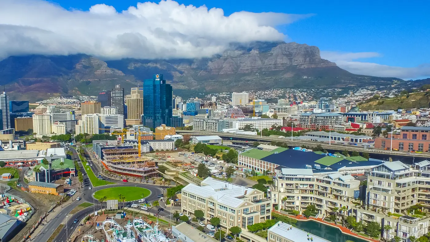
Cape Town keeps its one real hill for late in the race. The first 22 km climb in small lumps of 10 to 20 m, over a flyover, a viaduct and a long drag up Main Road, and none of it is steep. Then the road drops to sea level for five kilometres, and from the Castle of Good Hope at about km 29.8 it rises 24 m in two kilometres, up Darling Street and through the Company’s Garden to the high point of the course at about km 31.8. That climb comes when the legs have the least to give, and everything after it, ten kilometres down to the Atlantic and along it, rewards a runner who still has something left.
The course is a loop from Green Point out to the southern suburbs and back through Woodstock and the city centre, with an out and back along the sea at the end. The kilometres and heights below are measured along the organiser’s 2026 route, the latest it has published; the 2027 map is not out yet, so check the organiser’s marathon page before you plan around a particular street. The 2027 race has two start lines, the Stadium start on Fritz Sonnenberg Road and the Beach Road start in Mouille Point, and the two fields join on Beach Road before the course turns onto Granger Bay Boulevard.
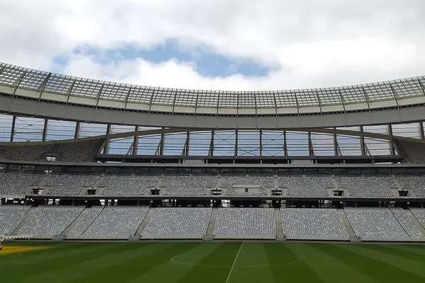
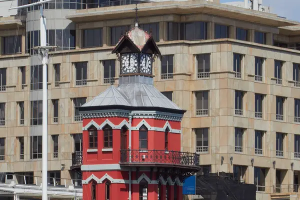
The Stadium start is at about 9 m on Fritz Sonnenberg Road, beside the stadium. The course runs along Beach Road, turns onto Granger Bay Boulevard and then Helen Suzman Boulevard, along the edge of the V&A Waterfront, and by km 2.5 it has already risen to 17 m. It crosses the Helen Suzman Boulevard flyover from about km 2.7 to 3.3, and the organiser’s map marks the Waterfront and a Table Mountain view point around km 3.5. The road then drops back to 6 m at about km 3.9.
Nelson Mandela Boulevard carries the course out of the city centre on a viaduct, from about km 3.8 to km 6.1, and climbs to about 26 m at km 6.4. Searle Street brings it to Victoria Road and the first of the organiser’s cut-off points, at km 7.0.
Sir Lowry Road leads onto Main Road at about km 8.5, and Main Road carries the course for more than five kilometres through the suburbs south of the city. This is the longest climb of the first half: from 14 m at about km 7.4 to 32 m at km 9.6, 18 m in 2.2 km. The road comes back down to 15 m by km 12, passing the Baxter Theatre in Rondebosch at about km 11.8 and the Presidential Estate, which the organiser’s map marks at km 12.7, then climbs again to about 28 m at km 14.6, where Claremont Boulevard takes over.
Stanhope Road, Palmyra Road, Campground Road and Sandown Road lead into the southern turn of the course. Milner Road passes km 20, and the organiser’s map marks the Red Cross Hospital at about km 20.7. Klipfontein Road and Sawkins Road bring the course back onto Campground Road and towards the city. Through this whole stretch the road wanders between 15 m and 28 m, rolling rather than climbing.
Liesbeek Parkway runs from about km 22.2 to 26.2, and it brings the easiest running of the day: the road falls from 20 m to 5 m between km 22 and km 24, and from km 24 to km 29 it stays within a few metres of sea level. The lowest point of the course, 3.3 m, comes at about km 25.2, just before the Malta Road bridge. The spectator guide places the Salt River Circle at km 26.7.
Albert Road then takes the course through Woodstock, past the Old Biscuit Mill at about km 27, and Newmarket Street, Russell Street and Sir Lowry Road lead back into the city centre. Bank the flat here: the next two kilometres are the hardest of the race.
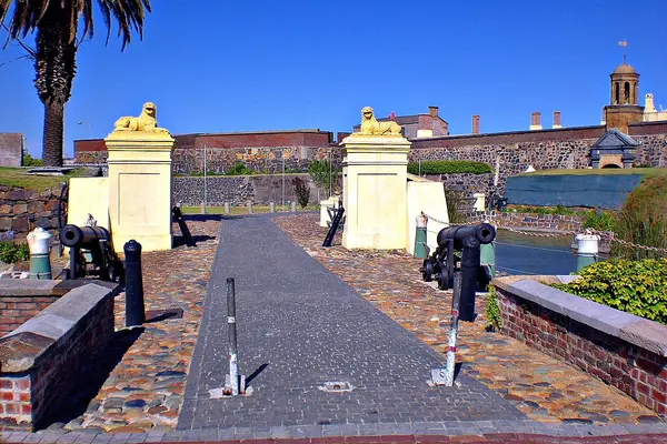
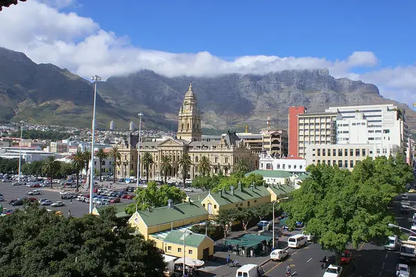
At about km 29.8 the course turns onto Darling Street past the Castle of Good Hope, the oldest colonial building in South Africa, and City Hall on the Grand Parade at about km 30.1. Adderley Street and Wale Street bring it past St George’s Cathedral at about km 30.7, and then it runs the length of Government Avenue through the Company’s Garden, past the Iziko South African Museum at about km 31.3. The spectator guide calls this stretch the steepest climb, and the numbers agree: from 9 m at km 29.8 the road rises to 33.2 m at about km 31.8, on Orange Street, the highest point of the course and 24 m in two kilometres. The organiser’s cut-offs fall at km 30.5 on Darling Street and km 32.6 on Long Street, so the clock is watching here too. Long Street then starts the descent.
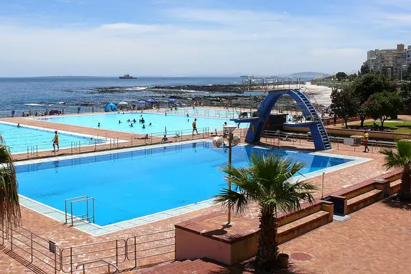
Riebeek Street, Buitengracht Street and Somerset Road lead to Main Road in Green Point, and the road keeps falling: 21 m at km 33.5, 12 m at km 35.5 and 8 m by km 37. The course passes close to the finish area here and then heads away from it, out along Beach Road through Sea Point to Queens Road Circle, where the organiser has a cut-off at km 38.7, and back. The Sea Point Pavilion comes at about km 38. The organiser’s spectator guide calls the Sea Point Promenade stretch, km 36.3 to 41.4, “The Loop”, and spectators there see the runners twice.
The final 5 km stay between 7 m and 12 m. Helen Suzman Boulevard and Vlei Road bring the course to the finish opposite the stadium at 11 m, 2 m above the start. The whole course climbs about 116 m.
A loop from Cape Town Stadium through the city centre, Woodstock and the southern suburbs, with Table Mountain in view for most of the route back to Green Point.
The Cape Town Marathon is a loop of 42.2 km with 116.2 m of climbing. Its lowest point is 3 m and its highest 33 m above sea level. Next race: Sunday 23 May 2027.
Time not published
Time not published
Time not published
Times as published by the organiser, in Cape Town time, checked .
The forecast for Sunday
We hold no start time for this race, so the record is read at 09:009:00 AM, local time.
Add to calendar .ics file, times in Cape Town time
The organiser has not published the 2027 expo dates and hours. In 2026 the expo was at the DHL Stadium in Green Point, beside the start: on Thursday 21 May from 09:00 to 19:00, Friday from 09:00 to 18:00 and Saturday from 10:00 to 17:00. Runners brought their official entry confirmation with its unique QR code, on email or WhatsApp. A runner could collect for someone else by showing that runner’s confirmation, and there were no late collections on race day.
All 2027 start times are still to be announced. In 2026 the wheelchair athletes set off from the Stadium start at 07:50, the elite field at 08:00, a World Marathon Majors Age Group World Championship wave from the Beach Road start at 08:05, and the final wave at 09:06. Your seeding information says which of the two starts is yours.
There are 15 hydration stations on the marathon route, about 3 km apart. Thirteen of them hand out water, Coke, Coke No Sugar and Powerade; the other two are water only.
The marathon has a limit of 6.5 hours, and the organiser lists intermediate cut-offs on its route map. On the most recent published table they sit at ten points between km 7.0 and km 41.4, including two in the city-centre climb. In 2026 the final cut-off was at 15:50.
Ballot closed for the 2027 race As read 25 September 2026.
The organiser, a third party. We take no entries and have no part in the race.
The MyCiTi A01 bus runs between Cape Town International Airport and the Civic Centre station in the city centre, every 30 minutes, and needs no myconnect card. Sources disagree on the fare, so check it on the MyCiTi site before you travel. The Civic Centre is also where the race-morning shuttles to the start left from in 2026.
The start, the finish and the 2026 expo all sit in Green Point, around the stadium, and the Beach Road start is a short way along the sea in Mouille Point. Staying in Green Point or Mouille Point puts the start within walking distance and spares you the early shuttle. Sea Point is on the course itself, on the closing loop between km 36 and km 41, and the V&A Waterfront is passed at about km 3. The city centre is the other option: in 2026 the free shuttles to the start left from the Civic Centre, Thibault Square and the CTICC.
In 2026 free MyCiTi shuttles ran to the start from the Civic Centre, Thibault Square and the CTICC between 05:30 and 06:45, and back from 11:00 to 17:30. Park and ride buses ran from Century City and UCT, the first at 05:30 and the last to the start at 06:30, returning from the MyCiTi Stadium station from 11:00 until 17:30. The Civic Centre parking bays opened from 05:00 to 18:00. A special event train ran for spectators, a return costing R20.
In 2026 roads were affected for several hours on both the Saturday and the Sunday, with closures across the Atlantic seaboard, the city centre, Salt River and the southern suburbs, among them Helen Suzman Boulevard, Beach Road, Nelson Mandela Boulevard, Liesbeek Parkway and Main Road. Parking restrictions started on the Friday in 2026, cars in the restricted areas were towed, and the city warned of little to no parking in the stadium precinct. Several MyCiTi routes, including the inner city, Sea Point and Camps Bay, ran disrupted services on race day. The organiser’s information page carries the closure maps by area.
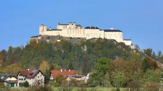
Salzburg, Austria
Sun 23 May 202742.2 kmClimb 79 m
Climb summed after smoothing the heights over 1 km. The edge is this course's height profile on one scale for every race: 250 m above its lowest point fills it. Photo: Hohensalzburg Fortress, by C.Stadler/Bwag, CC BY-SA 4.0, via Wikimedia Commons.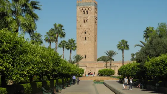
Marrakech, Morocco
Sun 31 Jan 202742.2 kmClimb 116 m
Climb summed after smoothing the heights over 1 km. The edge is this course's height profile on one scale for every race: 250 m above its lowest point fills it. Photo: Koutoubia Mosque, by Baca12, CC BY-SA 4.0, via Wikimedia Commons.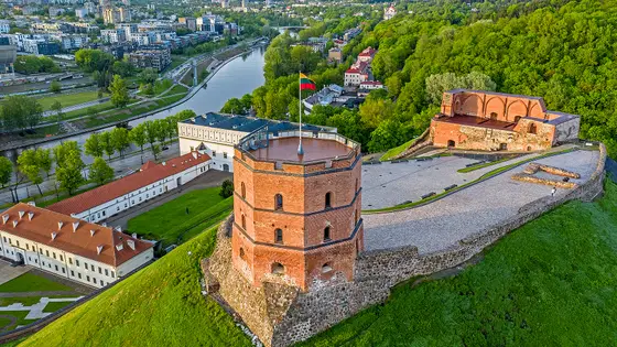
Vilnius, Lithuania
Sun 12 Sep 202742.2 kmClimb 116 m
Climb summed after smoothing the heights over 1 km. The edge is this course's height profile on one scale for every race: 250 m above its lowest point fills it. Photo: Gediminas' Tower, by BigHead, CC BY-SA 4.0, via Wikimedia Commons.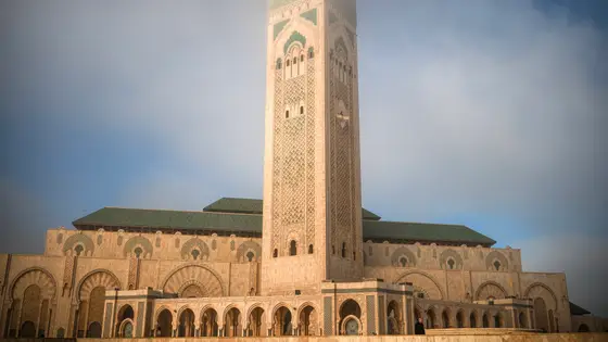
Casablanca, Morocco
Oct 202742.2 kmClimb 119 m
Climb summed after smoothing the heights over 1 km. The edge is this course's height profile on one scale for every race: 250 m above its lowest point fills it. Photo: Hassan II Mosque, by Tinuzzo, CC BY 4.0, via Wikimedia Commons.Sunday 23 May 2027. The Peace Runs and Trail Runs are on Saturday 22 May. It is the first Cape Town Marathon run as an Abbott World Marathon Major. The organiser says all 2027 start times will be published closer to race day.
General places for 2027 went by ballot, which ran from 10 to 24 June 2026, with every applicant told the result by email on 26 June. Charity entries and entries sold with the race's official international travel packages opened on 26 June 2026, first come, first served.
Not very. On the 2026 route the whole course climbs about 116 m, mostly in lumps of 10 to 20 m in the first half. The one sustained climb comes late: 24 m in about two kilometres, from Darling Street up through the Company's Garden to the high point, 33.2 m at about km 31.8. After that the road falls gently to the finish.
6.5 hours for the marathon. The organiser also sets intermediate cut-offs, printed on its route map. In 2026 the final cut-off was at 15:50.
From two start lines: the Stadium start on Fritz Sonnenberg Road beside the stadium in Green Point, and the Beach Road start in Mouille Point. Your seeding information says which one is yours. The two fields join on Beach Road early in the race.
In 2026 free MyCiTi shuttles ran to the start from Civic Centre, Thibault Square and the CTICC between 05:30 and 06:45, and park and ride buses ran from Century City and UCT, the last one to the start at 06:30. The city warned of little to no parking in the stadium precinct, and cars left in restricted areas were towed.
Yes, from 2027. The Abbott World Marathon Majors confirmed in June 2026 that Cape Town joins the series as its eighth member, the first in Africa, and the race on 23 May 2027 is its first as a Major.
Not entirely. It has 116.2 m of climbing over 42.2 km. The highest point is 30 m above the lowest.
The 2027 ballot has closed. It opened on 10 June 2026, closed on 24 June and the results came out on 26 June. There are 3 ways in: General ballot, Official travel packages and Charity entry. Entry details on the organiser’s site
Runners have 6 h 30 min to finish.
The Cape Town Marathon traces its history to 1994, to a race run by the Celtic Harriers club from Mutual Park in Pinelands. Sanlam became the title sponsor in 2014, and in 2017 the race became the first in Africa to earn IAAF Gold Label status. The 2020 race was cancelled for the pandemic.
The 2025 race was set for Sunday 19 October and was cancelled on race morning, after severe winds damaged event infrastructure and made the route unsafe. The next race was run on 24 May 2026, for about 27,000 runners, and in June 2026 the Abbott World Marathon Majors confirmed Cape Town as the eighth Major and the first in Africa, from the 2027 race. Sanlam’s sponsorship runs to 2031.
The course records are recent. The 2026 race brought three of them: Mohamed Esa of Ethiopia ran 2:04:55, David Weir of Great Britain won the men’s wheelchair race in 1:30:20, and Manuela Schär of Switzerland won the women’s in 1:43:25. The women’s record belongs to a South African: Glenrose Xaba ran 2:22:22 in 2024.
Checked against these sources on .