
Ballot closed for the 2027 race As read 25 September 2026.
Past years and every way in
Entry details on the organiser’s site →
Big Sur Marathon Foundation, a third party. We take no entries and have no part in the race.
 Marathon Trip
Your trips on every device: sign in, or make a free account when you save one.
Signed in on this browser.
Sign in My marathons Account and dataLocked out? An export link you keep still opens your list in any browser.
No account: email it to me
One email with this trip and a link to open it again. We do not keep the address and send nothing else.
Only a race from our list can be emailed. An account keeps this one.
What we keep, and what we do notCheck your inbox at to confirm it.
Browse the racesEach edition the day it comes out, and nothing else. Off again with one click. How it is kept.
A long climb of 135 m from km 7 to km 19, downhill to km 27, then downhill home from km 36.
© OpenStreetMap contributors
km 6mile 3.7
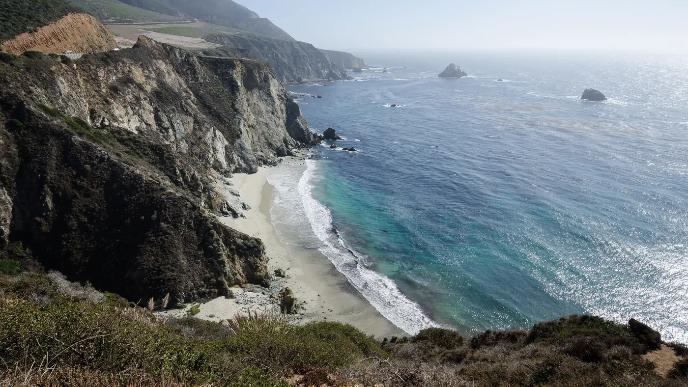
The state park on the coast between the Big Sur River and Point Sur, where the course comes down to the sea in the first 10 km. 67 m from the line at its nearest.
Photo: Pacific Southwest Region USFWS from Sacramento, US, Public domain
km 12.9mile 8
The lighthouse on its volcanic rock, seen across the bay from the road around mile 8, 1.4 km off the line at its nearest.
Photo: Thomson M, CC BY 3.0
km 19.1mile 11.9
The high point of the course at mile 12, 171 ft above the sea, reached by the long climb out of the Little Sur valley.
Photo: Thomson200, CC0
km 21mile 13
The 1932 concrete arch the course crosses at mile 13.1, the one place on the route with a piano on the road. 15 m from the line at its nearest.
Photo: John Dillenbeck, CC0
km 22.1mile 13.7
The second of the Highway 1 arch bridges, half a mile past Bixby.
km 30.6mile 19
The headland the course runs past at mile 19, high above the surf.
Photo: Alexander Hatley, CC BY 2.0
km 35.6mile 22.1
The headland at mile 22 where the course leaves the open coast for the Carmel Highlands.
km 37mile 23
The Carmel Highlands hotel above the road, passed at about mile 23.
km 38.6mile 24
The state reserve at mile 24, with its cypress headlands, 114 m from the line.
Photo: Sharon Mollerus, CC BY 2.0
Height drawn many times taller than life. Heights: USGS 3DEP 1 m digital elevation model.
Dashed: bridge

Your 5 gels, at the orange marksFor a 4:00 finish, one every 40 minutes
Get them on AmazonAmazon partner link
Big Sur is a race against a road. Highway 1 is the only route along 90 miles of the central California coast, and the organiser’s permit makes it reopen at 1 PM, so the six-hour limit is fixed, with clock cut-offs at miles 15.2 and 21.2. Inside those six hours the course puts its one big climb in the middle: 137 m up to Hurricane Point between km 15.6 and km 19.0, the highest ground of the race, and then 131 m back down past Bixby Bridge. A runner who arrives at the foot of that climb with something left, and still has legs after the descent, has the hard part done.
The course runs north on Highway 1 from Big Sur Station to Rio Road in Carmel, one road from start to finish. Kilometres and heights below are measured on a line walked from the organiser’s course map, on the USGS 1 m elevation model smoothed over a kilometre; the mile points are the organiser’s, converted. The organiser’s own figures are larger (a start at 356 feet, a finish at 10 feet and 2,182 feet of climbing) because they count every short rise and fall along the cliffs. The organiser also warns of a “sometimes-fierce head wind”.
The race starts at 6:45 AM at the Pfeiffer Multi-Use Facility at Big Sur Station, among the redwoods of the Big Sur valley. The first 6 km are the gentlest of the day: the road loses about 40 m on its way down the valley and reaches the sea by Andrew Molera State Park at about km 6. The first aid station is at mile 2.5, about km 4.0.
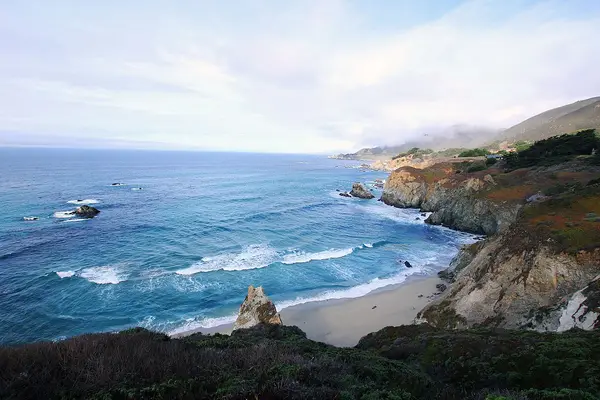
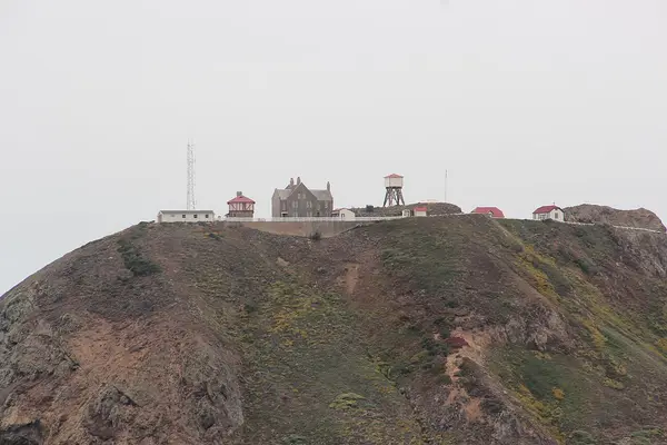
From Andrew Molera the course runs along the ranch land above the ocean. It rolls rather than climbs, rising slowly from about 27 m at km 6.6 to 68 m at km 14.0, with Point Sur Light Station on its volcanic rock across the bay around mile 8, about km 12.9. Just past km 14 the road drops 38 m into the Little Sur valley and reaches the foot of the climb at km 15.6, at 24 m. Save something here: what comes next is the race.
The climb is one sustained rise of 137 m in 3.4 km, about 4% on average, from 24 m to 161.6 m, the highest point of the course, near mile 12. The organiser puts Taiko drummers halfway up it. The first gel of the day, Precision Fuel PF 30, is at the mile 12.2 aid station, about km 19.6, just over the top.
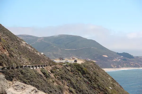
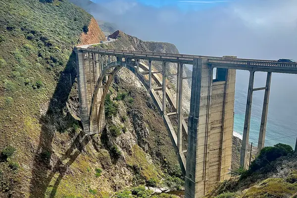
From Hurricane Point the road drops 131 m in 7.8 km. Bixby Creek Bridge, the 1932 concrete arch, is crossed at halfway, mile 13.1, about km 21, and the organiser calls it the centerpiece of the course: a tuxedo-wearing concert pianist plays a Yamaha piano on the road there. Rocky Creek Bridge, half a mile on, is the second of the arch bridges. The descent is not uninterrupted: the road climbs 14 m between km 22.2 and km 23.2 before falling again. The first cut-off is at mile 15.2, about km 24.5, at 10:30 AM. A runner who crosses the start line at 6:45 has 3 hours 45 minutes to get there, about 9:12 per km.
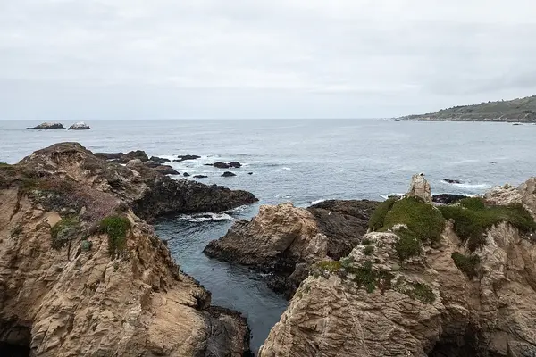
The last 15 km climb another 75 m in short rises. The road climbs to about 50 m by km 28.0, crosses Granite Canyon Bridge at about km 28.9, and passes Soberanes Point, high above the surf, around mile 19, about km 30.6, where the second gel is handed out. The second cut-off is at mile 21.2, about km 34.1, at 11:50 AM. Right after it comes the last climb that matters, 26 m between km 34.2 and km 35.6, up to Yankee Point, where the course leaves the open coast for the Carmel Highlands.
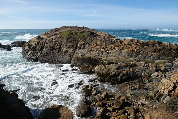
The rest falls almost 50 m to the finish. The Strawberry Station, with strawberries about three miles from the finish, is at mile 23.2, about km 37.3. The course passes Point Lobos and its cypress headlands at mile 24, about km 38.6, where the organiser puts belly dancers by the road, and the last aid station is at mile 24.5. The finish is on Highway 1 at Rio Road, in Carmel.
Point to point along Highway 1 from Big Sur Station to Carmel, crossing Bixby Bridge and Hurricane Point above the Pacific, with the field limited to about 4,500 runners.
The Big Sur International Marathon is a hilly point-to-point course of 42.2 km (26.2 miles) with 287.6 m (944 ft) of climbing. Its lowest point is 9 m (30 ft) and its highest 162 m (531 ft) above sea level. Next race: Sunday 25 April 2027, starting at 6:45 AM.
12:0012:00 PM–18:006:00 PM
09:309:30 AM–18:006:00 PM
04:454:45 AM–05:455:45 AM
06:456:45 AM
09:309:30 AM–14:002:00 PM
13:001:00 PM
10:3010:30 AM
11:5011:50 AM
Times as published by Big Sur Marathon Foundation, in Big Sur time, checked .
The forecast for Sunday
Add to calendar .ics file, times in Big Sur time
The 2027 Health and Fitness Expo is at the Monterey Conference Center, 1 Portola Plaza, Monterey, on Friday 23 April from 12 to 6 PM and Saturday 24 April from 9:30 AM to 6 PM. Bibs and shirts are picked up there in person, with photo ID and the check-in pass, a QR code and bib number emailed to you several times before race weekend. Each runner collects their own: friends and family may not, and the organiser adds “No exceptions”. Official merchandise is sold only at the expo and at Marathon Village on race day.
Every marathon runner rides the free race bus to the start unless staying in Big Sur. Highway 1 is closed to private vehicles early on race morning, and there is no parking or drop-off at any start. In March 2027 runners choose a pick-up location on the Monterey Peninsula in their haku account; those who do collect the bus ticket with their bib at the expo, and those who do not go to the Transportation Desk at the expo for whatever is left. Show your bib and bus ticket to board.
The buses run early because the road is slow. Loading starts at 3:30 AM, departures are staggered between 3:30 and 4:00 AM, and the last buses must leave by 4:30 AM: the organiser says a bus needs an hour to reach Big Sur safely on the narrow road in the dark, and another hour to come back. Water and hot drinks are available at most start areas. The 2027 participant guides, with the details of the start area, had not been published by late October 2026.
There are 11 aid stations, at miles 2.5, 4.8, 7.8, 10.4, 12.2, 14.7, 16.9, 19.0, 21.2, 23.0 and 24.5, with Precision Hydration PH 1000, water, bottle refills, portable toilets and first aid. Gels are at miles 12.2 and 19.0, and fruit at the later stations. There are large mile markers but no clocks or split callers, so carry a watch. The course is shared with the relay and the shorter races, and the organiser strongly discourages headphones; unofficial pacers are not allowed. The organiser gives the average race-morning temperature as 50 to 60 degrees F, but race days have brought gale-force winds, hail and thick fog.
Finishers get their medallion, water and, when needed, a heat sheet, then go through the food tent to the finish village, with live music, hot soup and a beer garden for over-21s. Families meet runners at the Runner Reunion area by the food tent. Return shuttles leave the finish village between 9:30 AM and 2 PM for the morning departure points, including Big Sur.
Ballot closed for the 2027 race As read 25 September 2026.
Big Sur Marathon Foundation, a third party. We take no entries and have no part in the race.
Monterey Regional Airport (MRY) serves the peninsula. Monterey-Salinas Transit runs public buses to and from the airport, and taxis, which add a USD 4 airport surcharge, Uber and Lyft all serve it. The airport does not give travel times to Carmel or Monterey.
Three areas line up with race weekend. Monterey has the expo at the Conference Center and is on the peninsula where the race buses leave from. Carmel has the finish at Rio Road, where the return shuttles leave, and the Crossroads Carmel shopping centre, which the organiser names for parking on race day for the shorter races. Big Sur itself, near the start, has hotels, motels and campgrounds: two race-morning shuttles loop Highway 1 from 4:45 to 5:45 AM, one about two miles north of the start and one about two miles south, and runners wait by the highway for them. Staying in Big Sur saves the 3:30 AM bus, but Highway 1 stays closed to traffic until 1 PM, and the return shuttles from the finish are the way back.

Hamburg, Germany
Sun 25 Apr 202742.2 kmClimb 98 m
Climb summed after smoothing the heights over 1 km. The edge is this course's height profile on one scale for every race: 250 m above its lowest point fills it. Photo: Elbphilharmonie, by Burkhard Mücke, CC BY-SA 4.0, via Wikimedia Commons.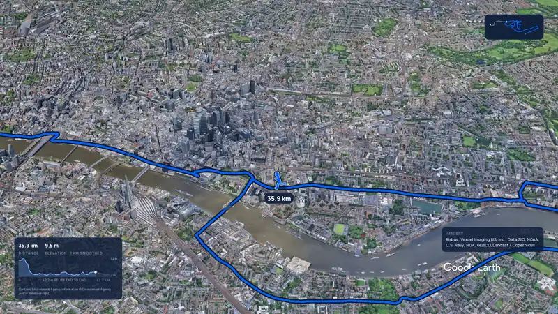 Imagery: Google Earth4:02 film
London, United Kingdom
Sun 25 Apr 202742.2 kmClimb 42 m
Climb summed after smoothing the heights over 1 km. The edge is this course's height profile on one scale for every race: 250 m above its lowest point fills it.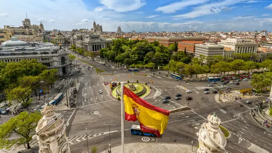
Madrid, Spain
Sun 25 Apr 202742.2 kmClimb 206 m
Climb summed after smoothing the heights over 1 km. The edge is this course's height profile on one scale for every race: 250 m above its lowest point fills it. Photo: Plaza de Cibeles, by Miguel Diaz from Boadilla del Monte, España-Spain, CC BY-SA 2.0, via Wikimedia Commons.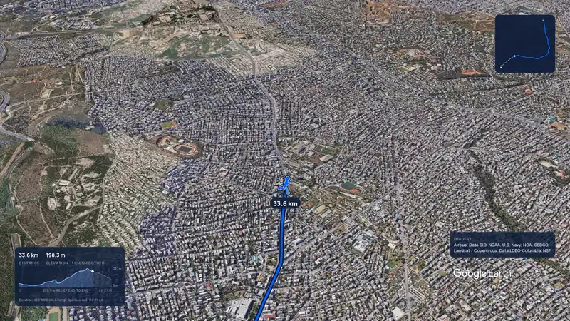 Imagery: Google Earth3:56 filmRace week
Athens, Greece
Sun 8 Nov42.2 kmClimb 281 m
Climb summed after smoothing the heights over 1 km. The edge is this course's height profile on one scale for every race: 250 m above its lowest point fills it.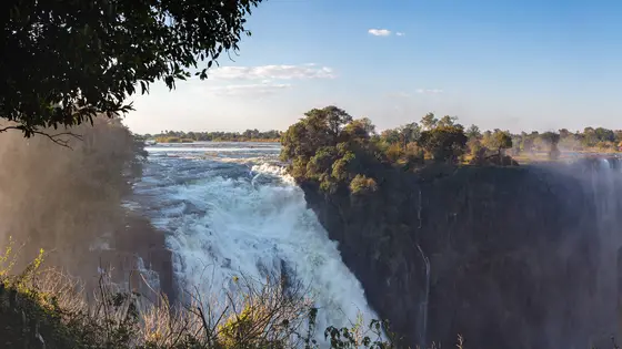
Victoria Falls, Zimbabwe
Sun 4 Jul 202742.2 kmClimb 270 m
Climb summed after smoothing the heights over 1 km. The edge is this course's height profile on one scale for every race: 250 m above its lowest point fills it. Photo: Victoria Falls, by Diego Delso, CC BY-SA 4.0, via Wikimedia Commons.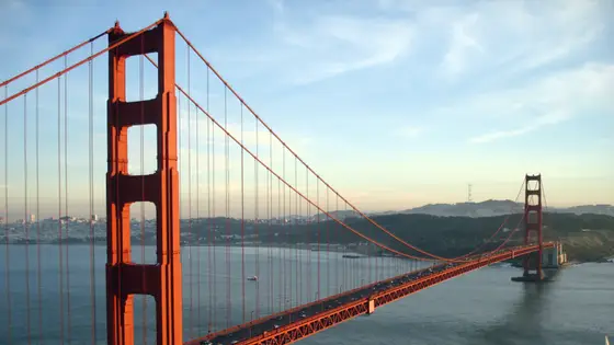
San Francisco, United States
Sun 25 Jul 202742.2 kmClimb 247 m
Climb summed after smoothing the heights over 1 km. The edge is this course's height profile on one scale for every race: 250 m above its lowest point fills it. Photo: Golden Gate Bridge, by Rich Niewiroski Jr., CC BY 2.5, via Wikimedia Commons.Sunday 25 April 2027, the 40th running. The marathon starts at 6:45 AM at Big Sur Station, with a pulsed start in three corrals, A to C, and finishes on Highway 1 at Rio Road in Carmel.
Six hours, a pace of 13:45 per mile, because Highway 1 has to reopen at 1 PM. There are two clock cut-offs: runners who have not reached mile 15.2 by 10:30 AM or mile 21.2 by 11:50 AM are not allowed to go on and are taken to the finish. There is no support of any kind on the course for anyone behind a six-hour pace.
The organiser calls it moderately difficult, with rolling hills. The big climb is Hurricane Point: 137 m between km 15.6 and km 19.0, to the highest point of the course, followed by a 131 m descent over the next 7.8 km. The organiser counts 2,182 feet of climbing in all along the cliffs, and warns of a sometimes fierce headwind.
By the free race bus, which every marathon runner must take unless staying in Big Sur. Runners choose a pick-up location on the Monterey Peninsula in their haku account in March 2027. Loading starts at 3:30 AM and the last buses leave by 4:30 AM. Highway 1 is closed to private vehicles early on race morning, and there is no parking or drop-off at the start.
At the Health and Fitness Expo at the Monterey Conference Center, 1 Portola Plaza, Monterey, on Friday 23 April 2027 from 12 to 6 PM or Saturday 24 April from 9:30 AM to 6 PM. Bring photo ID and the check-in pass emailed to you. Nobody can pick up a bib for another runner.
At halfway, mile 13.1, about km 21, on the descent from Hurricane Point. A concert pianist in a tuxedo plays a Yamaha piano beside the road there.
Brad Hawthorne's 2:16:39 from 1987, and Svetlana Vasilyeva's 2:41:34 from 1996. Both still stand. Hawthorne's has been threatened only once, by Jonathan Ndambuki in 2002.
No, it is a hilly course: 287.6 m (944 ft) of climbing over 42.2 km (26.2 miles). The highest point is 153 m (502 ft) above the lowest. It finishes 62 m (203 ft) lower than it starts.
The 2027 drawing has closed. It opened on 19 August 2026, closed on 2 September and the results came out on 8 September. There are 5 ways in: Random drawing, VIP entry, Charity entry, Official travel packages and Boston 2 Big Sur. Entry details on the organiser’s site
Runners have 6 hours to finish. The finish closes at 1:00 PM.
Start: Big Sur Station, Pfeiffer Multi-Use Facility.
Men: 2:16:39, Brad Hawthorne, 1987. Women: 2:41:34, Svetlana Vasilyeva, 1996.
The race began with a road sign. A sign on Highway 1 near Rio Road in Carmel gave Bill Burleigh the idea, and after a year spent on the permit and another organising the race, the first Big Sur International Marathon was run on the last Sunday in April 1986, with 1,800 runners on the 26.2 miles from Big Sur to Carmel. The organiser remembers a 700-pound Hereford cow in labour on the course, and residents who ignored the road closure.
The coast has kept testing it. Spring rains in 1995 brought floods that destroyed the Carmel River Bridge just before the finish, and in 1998 and 2011 sections of Highway 1 fell into the ocean after heavy rain and mudslides; temporary course changes kept the race going. Shorter events were added around it: the walk that became the 11-Miler in 1989, the 21-Miler and the relay in 1995, and in 2010 the Boston 2 Big Sur Challenge, for runners who race Boston and then Big Sur, six days apart in 2027. The organiser now calls it the largest rural marathon in the world, and the field is limited to about 4,500. The 2027 race is the 40th running, and general registration for it sold out on 16 October 2026.
Both course records are decades old. Brad Hawthorne ran 2:16:39 in 1987, won five of the next six races, and saw his record threatened only once, by Jonathan Ndambuki in 2002. Svetlana Vasilyeva set the women’s record of 2:41:34 in 1996 (the winners table on the organiser’s records page gives 2:41:45). The race pays no prize money, and the winning times show how hard the road is: in 2023 Ben Bruce won in 2:37:00 and Anne Flower in 2:56:00.
Checked against these sources on .